Using Photogrammetry to Reconstruct Landscapes
An early experiment in reconstructing physical spaces from captured image and video data.
The Inquiry
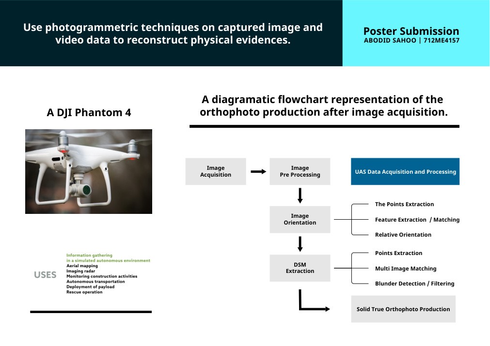
The study used aerial image acquisition and photogrammetric processing to turn overlapping visual data into measurable spatial outputs. The original workflow mapped image acquisition through preprocessing, image orientation, feature extraction and matching, DSM extraction, multi-image matching, filtering and solid true orthophoto production. A DJI Phantom 4 formed part of the acquisition setup. Years later, the method resurfaced at the Cambridge Cultural Heritage Data School: an earlier Agisoft PhotoScan workflow gave way to Polycam on an iPhone, connecting the technical language of engineering with later cultural-heritage and visual-research practice.
Outcome
A technical research poster and workflow study, presented as an origin point for the spatial and computational strand of the research practice.